2023 Map of Goshen
USGS Topo · Published 2023About this map
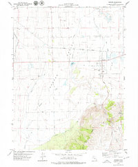
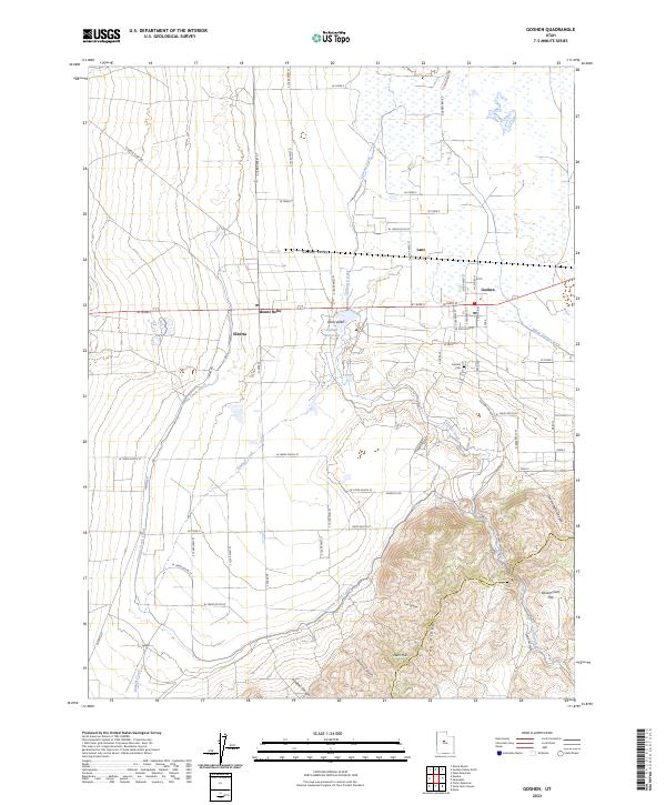
The agricultural landscape of Goshen Valley and the southern edge of Utah Valley are defined by an intricate network of water management systems. Significant irrigation infrastructure, including the Currant Creek Canal and Warm Springs Ditch, facilitates farming in this arid region, drawing from sources like the Goshen Reservoir. The settlement of Goshen serves as a central hub, accompanied by smaller locales such as Elberta, Mount Nebo, and Lant. To the south and east, the terrain shifts abruptly from the flat valley floor to the prominent elevations of Long Ridge and the West Hills. This transition is marked by several seasonal drainages and canyons, including Alcorns Canyon and Crooked Canyon, which descend toward the basin. The map also records the boundary between Utah Co and Juab Co, showing how political lines intersect with the natural topography of Government Flat.
Find a feature on this map
45 named features on this map. Tap any name to fly to it.
Don’t see what you’re looking for? This feature index may not catch every label — zoom into the map to look around manually.
Map Details
Editions of this 2023 Goshen Map
This is the sole edition of this map. No revisions or reprints were ever made.