2023 Map of Grafton
USGS Topo · Published 2023About this map
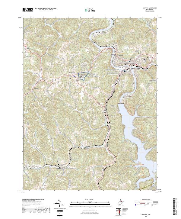
The Tygart Valley River flows through the heart of Taylor County, shaping a landscape defined by industrial history and significant commemorative sites. The city of Grafton serves as a central hub, flanked by its historic wards and neighboring communities like Fetterman, Blueville, and West Grafton. This area is particularly notable for its high concentration of cemeteries, including the Grafton National Cem and the West Virginia National Cem near Pruntytown, reflecting the region's deep civic and military heritage. To the southeast, the terrain transitions into the recreation-focused expanse of Tygart Lake. Transport infrastructure is prominent throughout the quadrangle, with the B & O RR following the river's path and the American Discovery Trl offering a cross-country route for modern travelers. Small hamlets such as Simpson, Flemington, and Webster dot the winding runs and ridges, preserving the traditional settlement patterns of northern West Virginia.
Find a feature on this map
58 named features on this map. Tap any name to fly to it.
Don’t see what you’re looking for? This feature index may not catch every label — zoom into the map to look around manually.
Map Details
Editions of this 2023 Grafton Map
This is the sole edition of this map. No revisions or reprints were ever made.
