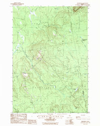
1988 Map of Greenfield
USGS Topo · Published 1988About this map
Greenfield and the surrounding timberlands of Penobscot and Hancock Counties are defined by a complex network of waterways and isolated elevations. The settlement at Greenfield sits at the intersection of local roads near the Cem on Cemetery Hill, marking a small human footprint in a landscape dominated by the Olamon Stream and its numerous tributaries. To the north, the terrain rises significantly toward Summit Mountain and the broad slopes of Passadumkeag Mountain, while the southern reaches feature low-lying wetlands and secluded bodies of water like Olamon Pond and Skunk Pond.
Find a feature on this map
29 named features on this map. Tap any name to fly to it.
Don’t see what you’re looking for? This feature index may not catch every label — zoom into the map to look around manually.
Map Details
Editions of this 1988 Greenfield Map
This is the sole edition of this map. No revisions or reprints were ever made.
Other maps of this area

1902 · Orono
USGS Topo · 1:62,500

1917 · Passadumkeag
USGS Topo · 1:62,500

1929 · Great Pond
USGS Topo · 1:48,000

1931 · Saponac
USGS Topo · 1:48,000

1932 · Great Pond
USGS Topo · 1:62,500

1934 · Saponac
USGS Topo · 1:62,500

1944 · Orono
USGS Topo · 1:62,500

1946 · Orono
USGS Topo · 1:62,500

1948 · Bangor
USGS Topo · 1:250,000

1954 · Millinocket
USGS Topo · 1:250,000
Featured Places
- Summit Township, ME
- T39 MD BPP, ME
- Grand Falls Township, ME
- Greenfield Township, ME
- Crocker Turn, Greenfield Township