
1922 Map of Gregg
USGS Topo · Published 1922About this map
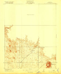
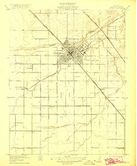
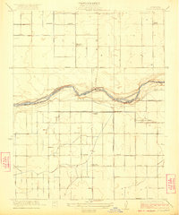
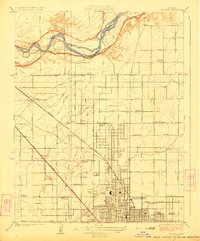
The agricultural and transit corridor of central California unfolds here during the early 1920s, a period defined by the dominance of the railroad in the San Joaquin Valley. Two major rail systems, the Southern Pacific and the Atchison Topeka and Santa Fe, bisect the landscape, dictating the placement of small rural junctions like Trigo and Gregg. These small settlements serve as hubs for the surrounding farmsteads, connected by a nascent road network including the State Highway and the Madera and Friant Road.
Find a feature on this map
12 named features on this map. Tap any name to fly to it.
Don’t see what you’re looking for? This feature index may not catch every label — zoom into the map to look around manually.
Map Details
Editions of this 1922 Gregg Map
This is the sole edition of this map. No revisions or reprints were ever made.
Other maps of this area

1912 · Mariposa
USGS Topo · 1:125,000
1919 · Little Table Mountain
USGS Topo · 1:31,680

1920 · Kismet
USGS Topo · 1:31,680

1921 · Daulton
USGS Topo · 1:31,680

1921 · Bullard
USGS Topo · 1:31,680

1922 · Lanes Bridge
USGS Topo · 1:31,680
1922 · Madera
USGS Topo · 1:31,680

1923 · Herndon
USGS Topo · 1:31,680
1923 · Biola
USGS Topo · 1:31,680
1923 · Bullard
USGS Topo · 1:31,680