2022 Map of Halstead
USGS Topo · Published 2022About this map
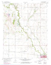
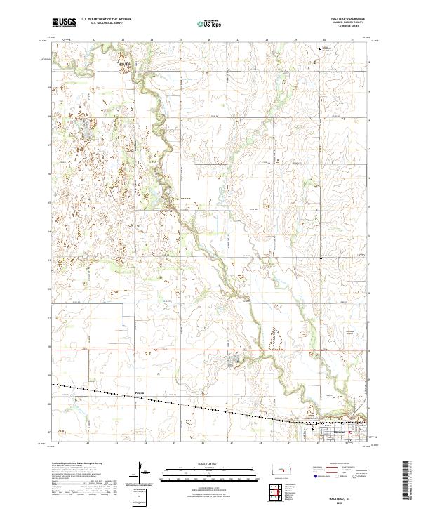
Halstead anchors this portion of Harvey County, situated where the Little Arkansas River begins its southward course through the region. The landscape is defined by the winding hydrology of the river and its tributaries, including Black Kettle Cr and N Br Kisiwa Cr, which carve through the grid-based agricultural layout of Central Kansas. Smaller settlements such as Alta Mills in the north and Paxton in the south reflect the area’s rural development and historical reliance on river proximity.
Find a feature on this map
52 named features on this map. Tap any name to fly to it.
Don’t see what you’re looking for? This feature index may not catch every label — zoom into the map to look around manually.
Map Details
Editions of this 2022 Halstead Map
This is the sole edition of this map. No revisions or reprints were ever made.