Loading...
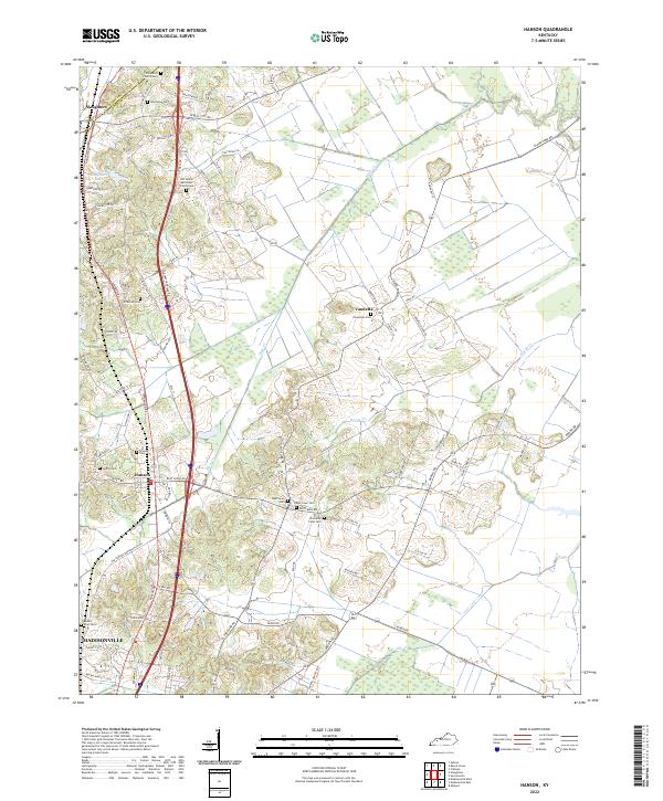
Loading map...2022 Map of Hanson
USGS Topo · Published 2022About this map
Hanson and Slaughters anchor this northern Hopkins County landscape, where the modern corridor of Pennyrile Dr cuts through a region defined by its small communities and watercourses. Low-lying wetlands along Otter Cr and Narge Cr segment the agricultural and residential areas, which are peppered with numerous family and community burial grounds. These small cemeteries, such as Crabtree Cem and Gooch Cem, speak to the deep genealogical roots of the rural population.
Find a feature on this map
88 named features on this map. Tap any name to fly to it.
Don’t see what you’re looking for? This feature index may not catch every label — zoom into the map to look around manually.
Map Details
Date Portrayed2022
Date Published2022
PublisherU.S. Geological Survey
Map TypeTopographic
Scale1:24000
Physical Dimensions24 x 29 inches
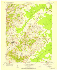
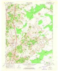
Editions of this 2022 Hanson Map
This is the sole edition of this map. No revisions or reprints were ever made.
Historical Maps of Madisonville Through Time
Featured Locations
Source Details
SourceU.S. Geological Survey
CopyrightPublic Domain