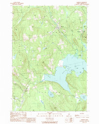
1989 Map of Harmony
USGS Topo · Published 1989About this map
The town of Harmony serves as a central hub in this late 20th-century landscape, situated where Higgins Stream and Mainstream Pond feed into the broader drainage system of the Sebasticook River. The settlement pattern reflects a reliance on these water routes and the adjacent high ground, with family names preserved in landmarks like Carson Hill and Talbot Hill. To the south, the massive expanse of Great Moose Lake dominates the terrain, featuring notable points like Passaconaway Point and the narrow passage of The Narrows.
Find a feature on this map
47 named features on this map. Tap any name to fly to it.
Don’t see what you’re looking for? This feature index may not catch every label — zoom into the map to look around manually.
Map Details
Editions of this 1989 Harmony Map
This is the sole edition of this map. No revisions or reprints were ever made.
Other maps of this area

1913 · Skowhegan
USGS Topo · 1:62,500

1930 · Pittsfield
USGS Topo · 1:48,000

1932 · Pittsfield
USGS Topo · 1:62,500

1933 · Pittsfield
USGS Topo · 1:62,500

1933 · Guilford
USGS Topo · 1:62,500

1937 · Guilford
USGS Topo · 1:62,500

1948 · Bangor
USGS Topo · 1:250,000

1948 · Kingsbury
USGS Topo · 1:62,500

1950 · Kingsbury
USGS Topo · 1:62,500

1954 · Millinocket
USGS Topo · 1:250,000