2021 Map of Hayti
USGS Topo · Published 2021About this map
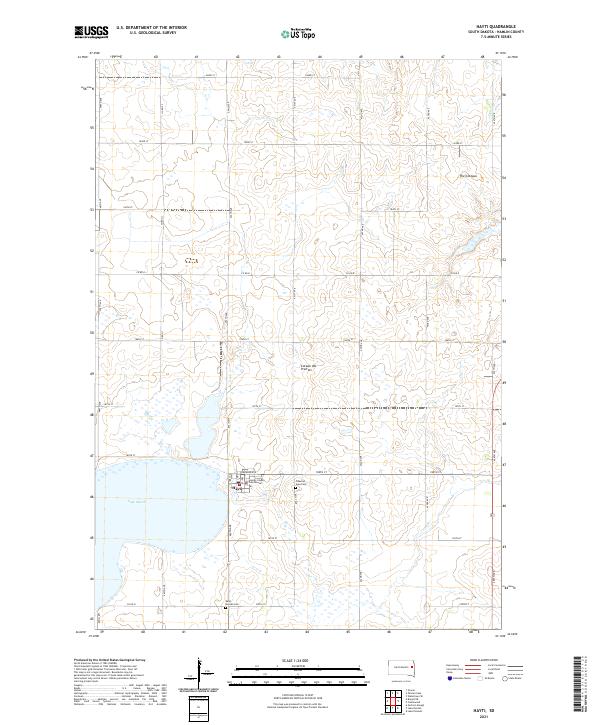
Hayti serves as the focal point of this Hamlin County landscape, situated along the eastern edge of Lake Marsh. As the county seat, the village is anchored by the Hamlin County Courthouse, surrounded by a regular grid of section-line roads such as Redbird Ave and 450th Ave. The terrain is defined by the unique geography of the Coteau des Prairies, an elevated plateau visible here through the glacial depressions and numerous small wetlands that dot the prairie. Local history is preserved at the Pleasant View Cem and West Norden Cem, while the broader regional landform of The Coteaus shapes the drainage and township boundaries. This survey illustrates the persistent agricultural structure of the region, where rural life remains organized around the township and range system.
Find a feature on this map
32 named features on this map. Tap any name to fly to it.
Don’t see what you’re looking for? This feature index may not catch every label — zoom into the map to look around manually.
Map Details
Editions of this 2021 Hayti Map
This is the sole edition of this map. No revisions or reprints were ever made.
Historical Maps of Florence Township Through Time
Featured Locations
- Castlewood Township, SD
- Cleveland Township, SD
- Opdahl Township, SD
- Oxford Township, SD
- Hayti, Hayti Township