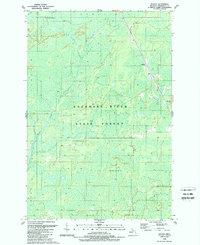
1989 Map of Helena
USGS Topo · Published 1989About this map
Escanaba River State Forest dominates this section of Marquette County, characterized by a complex network of wetlands and small watercourses. The tiny settlement of Helena sits along the eastern edge of the quadrangle, serving as a waypoint for the Chicago and North Western railroad which cuts through the forest. The landscape is defined by its low-lying hydrology, specifically the expansive Cyrus Swamp and drainage systems like Sawmill Creek and Mud Creek. Surveyed primarily in the 1950s and updated in the late 1980s, the map illustrates the persistence of the state forest lands and the sparse development of the northern Michigan interior. Aside from the rail line and a single primary road, the terrain remains largely untouched, preserving the natural drainage patterns that feed into the larger Escanaba River system.
Find a feature on this map
12 named features on this map. Tap any name to fly to it.
Don’t see what you’re looking for? This feature index may not catch every label — zoom into the map to look around manually.
Map Details
Editions of this 1989 Helena Map
This is the sole edition of this map. No revisions or reprints were ever made.
Other maps of this area

1932 · Skandia SW
USGS Topo · 1:31,680

1932 · Rock SW
USGS Topo · 1:31,680

1932 · Helena NW
USGS Topo · 1:31,680

1932 · Helena NE
USGS Topo · 1:31,680

1932 · Harvey SE
USGS Topo · 1:31,680

1932 · Harvey SW
USGS Topo · 1:31,680

1932 · Helena SW
USGS Topo · 1:31,680

1932 · Rock NW
USGS Topo · 1:31,680

1932 · Helena
USGS Topo · 1:31,680

1951 · Helena SW
USGS Topo · 1:31,680