2023 Map of Henlawson
USGS Topo · Published 2023About this map
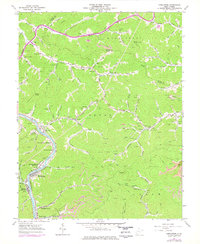
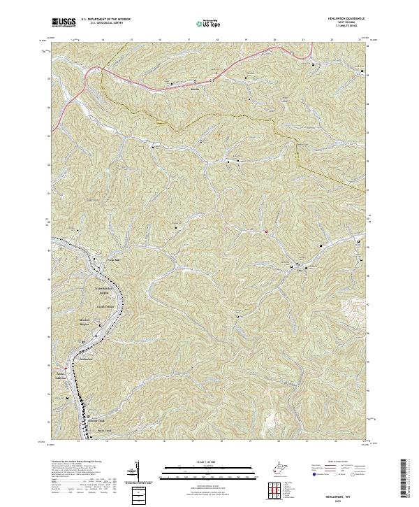
The Guyandotte River valley forms the primary corridor for settlement in this part of Logan County, where several distinct residential developments like North Mitchell Heights, Guyan Terrace, and Mitchell Heights are clustered along the river's eastern banks. The landscape is defined by its deep hollows and prominent ridges, including Big Dark Hollow and Little Dark Hollow, which emphasize the steep relief typical of the region. Transportation follows these natural drainages, with roads like Trace Fork Rd and Hurricane Branch Rd serving more isolated upland areas like Manila.
Find a feature on this map
133 named features on this map. Tap any name to fly to it.
Don’t see what you’re looking for? This feature index may not catch every label — zoom into the map to look around manually.
Map Details
Editions of this 2023 Henlawson Map
This is the sole edition of this map. No revisions or reprints were ever made.