2022 Map of Herbster
USGS Topo · Published 2022About this map
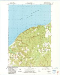
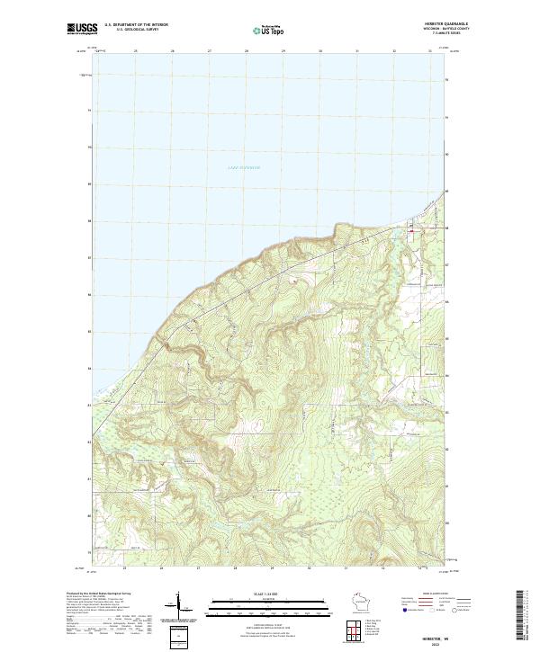
Lake Superior dominates the northern horizon of this coastal landscape in Bayfield County, where the shoreline is defined by the prominent reach of Bark Point Rd. The terrain is deeply etched by the drainage basins of the Flag River and the Cranberry River, which create a network of wooded ridges and valleys. A grid of local roads, many bearing the names of early resident families such as Beeksma Rd, Kleinhans Rd, and Bodeen Rd, reveals the enduring rural settlement pattern of the region. Notable infrastructure like Old School Rd and Clover Gravel Pit Rd provides markers for local history and industry, while the W Fork Cranberry River and E Fork Flag River trace the natural topography that has shaped development in the Herbster area for generations.
Find a feature on this map
38 named features on this map. Tap any name to fly to it.
Don’t see what you’re looking for? This feature index may not catch every label — zoom into the map to look around manually.
Map Details
Editions of this 2022 Herbster Map
This is the sole edition of this map. No revisions or reprints were ever made.