2022 Map of Hiltons
USGS Topo · Published 2022About this map
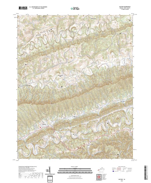
Clinch Mountain forms a massive central ridge that divides the landscape of Scott County, separating the Moccasin Valley to the north from Poor Valley to the south. This modern survey illustrates how topographic barriers have dictated settlement and transit, with the Norfolk Southern railroad and major roads forced through narrow passages like Dowell Gap and Hiltons Gap. Along the riverbanks and valley floors, many small family burial grounds are preserved, including the Dean Family Cem, Gardner Cem, and Spurrier Cem, providing a detailed record of the area's ancestral residents.
Find a feature on this map
123 named features on this map. Tap any name to fly to it.
Don’t see what you’re looking for? This feature index may not catch every label — zoom into the map to look around manually.
Map Details
Editions of this 2022 Hiltons Map
This is the sole edition of this map. No revisions or reprints were ever made.
Historical Maps of Maces Spring Through Time
1 maps found