2022 Map of Holmen
USGS Topo · Published 2022About this map
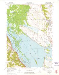
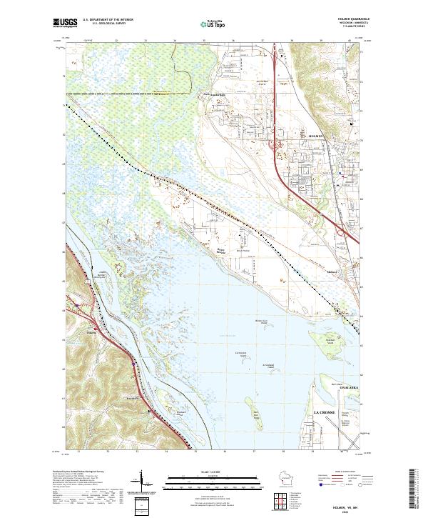
Lake Onalaska dominates the center of this landscape along the Mississippi River, where the state line divides Wisconsin from Minnesota. The river's complex braided channels include Hammond Chute, No Name Chute, and the Dresbach Slough, revealing a system of shifting waterways and low-lying islands like Broken Gun Island and Cormorant Island. On the eastern shore, the village of Holmen serves as a primary hub of development, while smaller historic settlements like New Amsterdam and Brice Prairie occupy the terraces of the Amsterdam Prairie.
Find a feature on this map
63 named features on this map. Tap any name to fly to it.
Don’t see what you’re looking for? This feature index may not catch every label — zoom into the map to look around manually.
Map Details
Editions of this 2022 Holmen Map
This is the sole edition of this map. No revisions or reprints were ever made.