2022 Map of Hookerton
USGS Topo · Published 2022About this map
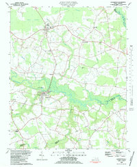
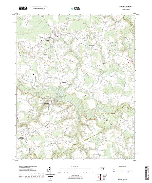
Contentnea Creek winds through this coastal plain landscape, serving as a central geographical feature for the established communities of Hookerton, Maury, and Ormondsville. The area is characterized by its agricultural heritage and natural wetlands, including the expansive Rices Pocosin and Half Moon Pocosin. These pocosins, along with several named swamps like Wheat Swamp and Eagle Swamp, define the local drainage patterns and have historically influenced the placement of farms and roads.
Find a feature on this map
85 named features on this map. Tap any name to fly to it.
Don’t see what you’re looking for? This feature index may not catch every label — zoom into the map to look around manually.
Map Details
Editions of this 2022 Hookerton Map
This is the sole edition of this map. No revisions or reprints were ever made.