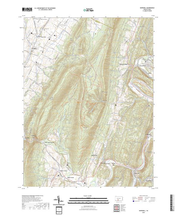
2023 Map of Hopewell
USGS Topo · Published 2023About this map
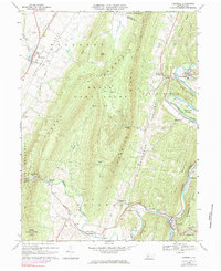
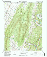
Morrisons Cove anchors the northwest corner of this region, where agricultural patterns meet the sharp relief of Tussey Mountain. The landscape is defined by the winding course of the Raystown Branch Juniata River and the corridor of the Huntingdon & Broad Top Mountain RR, which served the industrial and coal-mining interests of the Woodcock Valley. In the south, the settlement of Hopewell and nearby Langdondale illustrate the traditional layout of Pennsylvania river towns, with cemeteries such as Saint Pauls Cem and Bedford Forge Cem preserving the names of early settler families. The transition from the high ridges of Warrior Ridge to the valley floors of Yellow Creek reveals a complex network of rural roads like Woodbury Pike and Raystown Rd that connect historic clusters like Loysburg, Stonerstown, and Saxton.
Find a feature on this map
128 named features on this map. Tap any name to fly to it.
Don’t see what you’re looking for? This feature index may not catch every label — zoom into the map to look around manually.
Map Details
Editions of this 2023 Hopewell Map
This is the sole edition of this map. No revisions or reprints were ever made.
Historical Maps of Liberty Township Through Time
3 maps found