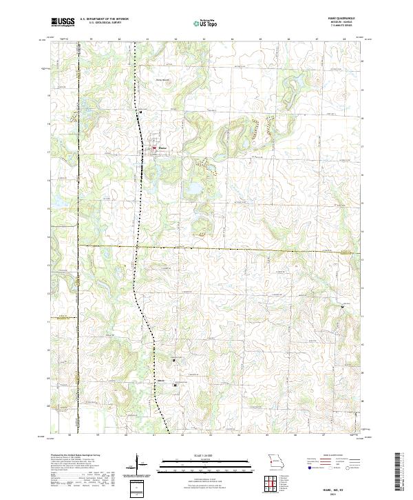
2021 Map of Hume
USGS Topo · Published 2021About this map
The town of Hume sits at the northern edge of this Missouri-Kansas borderlands survey, where the grid of rural roads meets the winding courses of Walnut Cr and Pryor Cr. This region of the Osage Plains is defined by its transition from open prairie to the wooded drainages of tributaries like Wolf Cr and Pecan Cr. To the south, the settlement of Amos is surrounded by a network of local roads such as E Brigade Rd and E Caton Rd, reflecting a landscape of dispersed farmsteads and agricultural heritage. Genealogists will find several significant burial grounds documented across the terrain, including Hume Cem, Lawrence Cem, Underwood Cem, and Clark Cem, which serve as vital markers of the area's early families. The elevation rises to Rocky Mound in the north, providing a rare topographical landmark in an otherwise gently undulating landscape of creek bottoms and low ridges.
Find a feature on this map
58 named features on this map. Tap any name to fly to it.
Don’t see what you’re looking for? This feature index may not catch every label — zoom into the map to look around manually.
Map Details
Editions of this 2021 Hume Map
This is the sole edition of this map. No revisions or reprints were ever made.
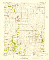
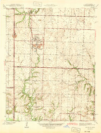
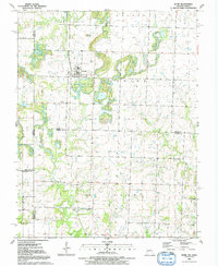
Historical Maps of Amos Through Time
4 maps found