2024 Map of Illinois City
USGS Topo · Published 2024About this map
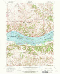
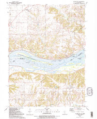
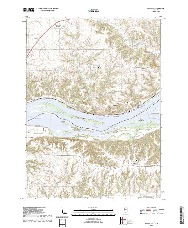
The Mississippi River creates a complex landscape of islands and side channels in this 2024 survey of the borderlands between Illinois and Iowa. Large landmasses such as Geneva Island, Hershey Island, and Goose Island are separated from the main banks by Wyoming Slough and the Andalusia Slough, reflecting a dynamic river environment. On the Illinois side, the settlement of Illinois City is positioned near Illinois City Cem and several upland drainages like Copperas Creek. Across the water in Iowa, the communities of Fairport, New Era, and Sweetland Center are linked by a network of rural routes including New Era Rd and Trolley Ave. The map identifies several family-named burial sites, such as Harker Cem and Krell Cem, providing valuable touchpoints for genealogists researching the residents of Rock Island and Muscatine counties.
Find a feature on this map
67 named features on this map. Tap any name to fly to it.
Don’t see what you’re looking for? This feature index may not catch every label — zoom into the map to look around manually.
Map Details
Editions of this 2024 Illinois City Map
This is the sole edition of this map. No revisions or reprints were ever made.
Historical Maps of Muscatine Through Time
3 maps found