1995 Map of Indian Mills
USGS Topo · Published 2000About this map
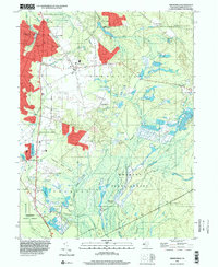
Hampton Furnace and the expansive network of Cranberry Bogs define this segment of the Pine Barrens at the end of the 20th century. The landscape is a mix of agricultural heritage and forest preservation, with much of the territory protected as part of the Wharton State Forest. Waterways like the Batsto River, Bread and Cheese Run, and Springers Brook feed the low-lying wetlands essential for the region's cranberry industry.
Find a feature on this map
37 named features on this map. Tap any name to fly to it.
Don’t see what you’re looking for? This feature index may not catch every label — zoom into the map to look around manually.
Map Details
Editions of this 1995 Indian Mills Map
This is the sole edition of this map. No revisions or reprints were ever made.
Other maps of this area

1888 · Pemberton
USGS Topo · 1:62,500

1888 · Mount Holly
USGS Topo · 1:62,500

1890 · Hammonton
USGS Topo · 1:62,500

1890 · Mullica
USGS Topo · 1:62,500

1894 · Hammonton
USGS Topo · 1:62,500

1894 · Pemberton
USGS Topo · 1:62,500

1894 · Mount Holly
USGS Topo · 1:62,500

1894 · Mullica
USGS Topo · 1:62,500

1898 · Pemberton
USGS Topo · 1:62,500

1898 · Mount Holly
USGS Topo · 1:62,500
Featured Places
- Southampton Township, NJ
- Tabernacle Township, NJ
- Shamong Township, NJ
- Meadford Farms, Tabernacle Township
- Oriental, Tabernacle Township