Loading...
Loading map...2022 Map of Inver Grove Heights
USGS Topo · Published 2022About this map
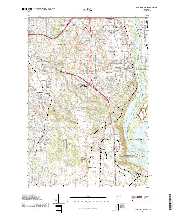
The Mississippi River corridor dominates this map, carving a wide path through the southeastern suburbs of the Twin Cities. Within the Mississippi National River and Recreation Area, the landscape is defined by riverine features like Upper Grey Cloud Island and River Lake. This area reflects a dense suburban infrastructure woven around numerous glacial water bodies, including Sunfish Lake, Marcott Lakes, and Schmidt Lake.
Find a feature on this map
228 named features on this map. Tap any name to fly to it.
Don’t see what you’re looking for? This feature index may not catch every label — zoom into the map to look around manually.
Map Details
Date Portrayed2022
Date Published2022
PublisherU.S. Geological Survey
Map TypeTopographic
Scale1:24000
Physical Dimensions24 x 29 inches
Editions of this 2022 Inver Grove Heights Map
This is the sole edition of this map. No revisions or reprints were ever made.
Historical Maps of Mendota Heights Through Time
Featured Locations
Source Details
SourceU.S. Geological Survey
CopyrightPublic Domain