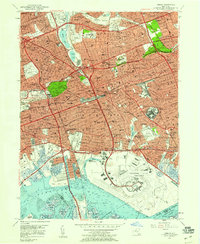
1957 Map of Jamaica
USGS Topo · Published 1959About this map
Jamaica and its surrounding Queens neighborhoods are shown here in a period of intense post-war density and transportation development. The sprawling footprint of the New York International Airport (Idlewild Field) dominates the southeastern quadrant, just as the aviation age was transforming the local landscape. To the west, the massive Aqueduct Race Track and nearby Jamaica Race Track underscore the area's mid-century role as a major regional entertainment destination.
Find a feature on this map
107 named features on this map. Tap any name to fly to it.
Don’t see what you’re looking for? This feature index may not catch every label — zoom into the map to look around manually.
Map Details
Editions of this 1957 Jamaica Map
This is the sole edition of this map. No revisions or reprints were ever made.
Other maps of this area

1889 · Brooklyn
USGS Topo · 1:62,500

1891 · Brooklyn
USGS Topo · 1:62,500

1891 · Harlem
USGS Topo · 1:62,500

1897 · Harlem
USGS Topo · 1:62,500

1897 · Brooklyn
USGS Topo · 1:62,500

1897 · Hempstead
USGS Topo · 1:62,500

1897 · Oyster Bay
USGS Topo · 1:62,500

1898 · Harlem
USGS Topo · 1:62,500

1898 · Hempstead
USGS Topo · 1:62,500

1898 · Brooklyn
USGS Topo · 1:62,500