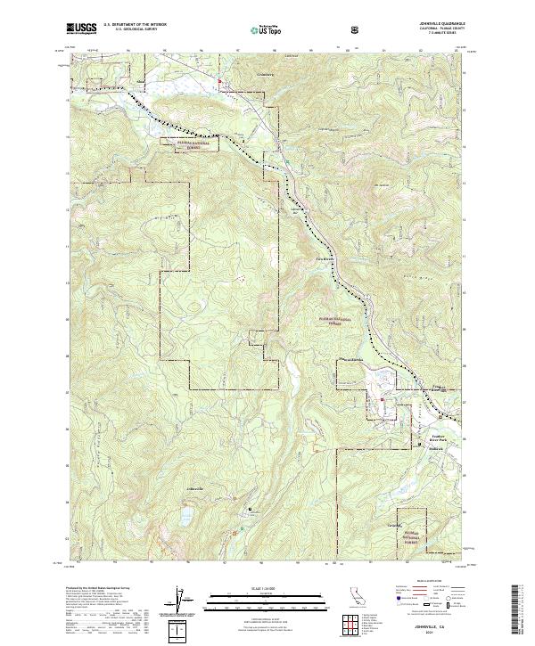
2021 Map of Johnsville
USGS Topo · Published 2021About this map
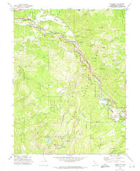
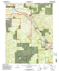
The Middle Fork Feather River carves a deep valley through the northern Sierra Nevada, anchoring a landscape defined by its mining and timber heritage. This 2021 survey shows the enduring footprint of historic settlements like Johnsville and Mohawk, where the Johnsville Cem and Mohawk Cem serve as quiet records of early Plumas County families. The map details the complex terrain of the Plumas National Forest, including the steep elevations of Eureka Ridge and Big Hill. In the eastern section, the Mohawk Valley opens up to host Graeagle and the landmark Feather River Inn. Outdoor recreation and conservation are evident through the Feather Wild and Scenic River corridor and trails such as the Madora Lake Loop Trl and the Lodgepole Trl, illustrating the shift from extraction to preservation in this high-altitude environment.
Find a feature on this map
70 named features on this map. Tap any name to fly to it.
Don’t see what you’re looking for? This feature index may not catch every label — zoom into the map to look around manually.
Map Details
Editions of this 2021 Johnsville Map
This is the sole edition of this map. No revisions or reprints were ever made.
Historical Maps of Cromberg Through Time
3 maps found