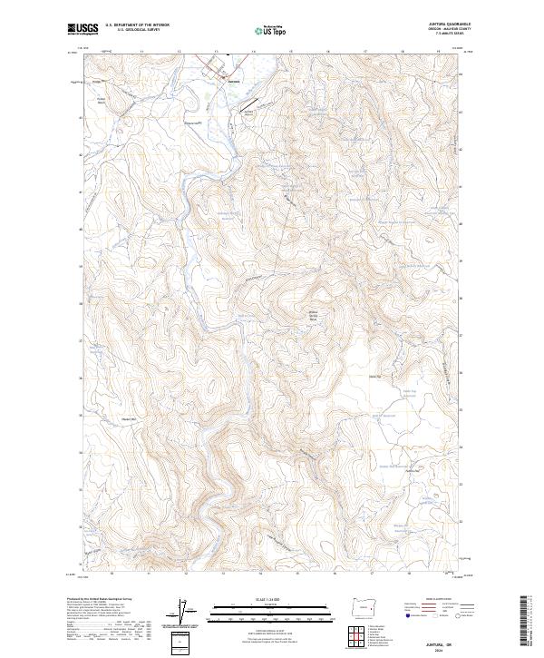
2024 Map of Juntura
USGS Topo · Published 2024About this map
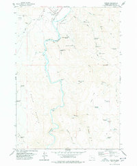
Juntura sits at the confluence of arid canyonlands and agricultural water management in eastern Oregon's high desert. The town's layout is defined by short residential streets like Hildah Rd and Frances St, with its survival tethered to the flow of the Malheur River. The landscape reveals a complex network of man-made water features designed to sustain life and livestock in the Juntura Valley, including the Townsite Ditch, Allen Ditch, and dozens of upland catchments like Chalk Bank Reservoir and New Place Reservoir.
Find a feature on this map
59 named features on this map. Tap any name to fly to it.
Don’t see what you’re looking for? This feature index may not catch every label — zoom into the map to look around manually.
Map Details
Editions of this 2024 Juntura Map
This is the sole edition of this map. No revisions or reprints were ever made.