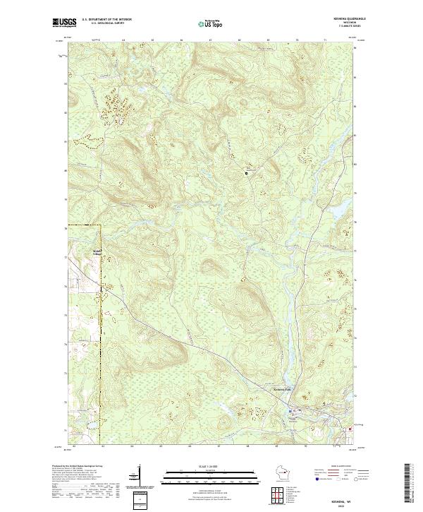
2022 Map of Keshena
USGS Topo · Published 2022About this map
Keshena Falls and Middle Village anchor this contemporary study of Menominee County, where the hydrological power of the West Branch Wolf River and the Wolf River dominates the landscape. The river system is marked by significant natural drop-offs, including Big Eddy Falls, Wolf River Rapids, and Bearcap Falls, highlighting the area's distinct river-valley topography. The map detail reflects the institutional and cultural center of the region, specifically locating the Menominee County Courthouse and numerous Bureau of Indian Affairs routes like BIA Rte 73. Local history and genealogy are preserved through markers such as the West Branch Cem and the naming of Crow Settlement Rd. To the west, the landscape softens around Malone Lake and various smaller tributaries like Oshkosh Cr and Chicken Cr, illustrating the dense network of wetlands and creeks that define this northern Wisconsin environment.
Find a feature on this map
48 named features on this map. Tap any name to fly to it.
Don’t see what you’re looking for? This feature index may not catch every label — zoom into the map to look around manually.
Map Details
Editions of this 2022 Keshena Map
This is the sole edition of this map. No revisions or reprints were ever made.
Other maps of this area

1952 · White Lake
USGS Topo · 1:48,000

1952 · Langlade
USGS Topo · 1:48,000

1954 · Gresham
USGS Topo · 1:48,000

1954 · Shawano
USGS Topo · 1:48,000

1954 · Iron Mountain
USGS Topo · 1:250,000

1955 · Green Bay
USGS Topo · 1:250,000

1959 · Iron Mountain
USGS Topo · 1:250,000

1964 · Shawano
USGS Topo · 1:62,500

1964 · Gresham
USGS Topo · 1:62,500
1973 · Fredenberg Lake
USGS Topo · 1:24,000