Loading...
Loading map...2024 Map of Kinston
USGS Topo · Published 2024About this map
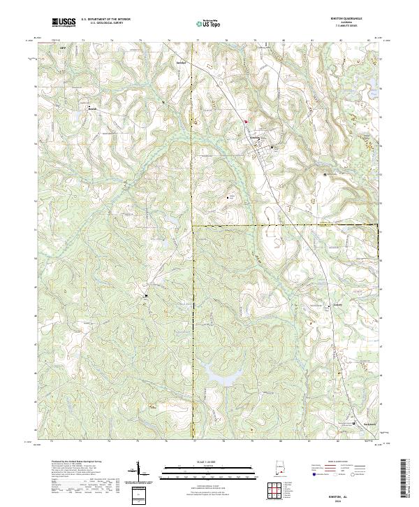
The town of Kinston serves as a central hub on this 2024 survey, situated where the rolling landscape of Coffee County meets the Pea River basin. The map captures a detailed snapshot of rural community life across several county lines, marking established hamlets like Beulah and Lowery. To the east, the Pea River meanders toward Hollys Ferry, a site that recalls the importance of river crossings before modern bridge infrastructure.
Find a feature on this map
106 named features on this map. Tap any name to fly to it.
Don’t see what you’re looking for? This feature index may not catch every label — zoom into the map to look around manually.
Map Details
Date Portrayed2024
Date Published2024
PublisherU.S. Geological Survey
Map TypeTopographic
Scale1:24000
Physical Dimensions24 x 29 inches
Editions of this 2024 Kinston Map
This is the sole edition of this map. No revisions or reprints were ever made.
Historical Maps of Estothel Through Time
Featured Locations
Source Details
SourceU.S. Geological Survey
CopyrightPublic Domain