2023 Map of Lake Stevens
USGS Topo · Published 2023About this map
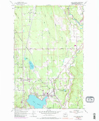
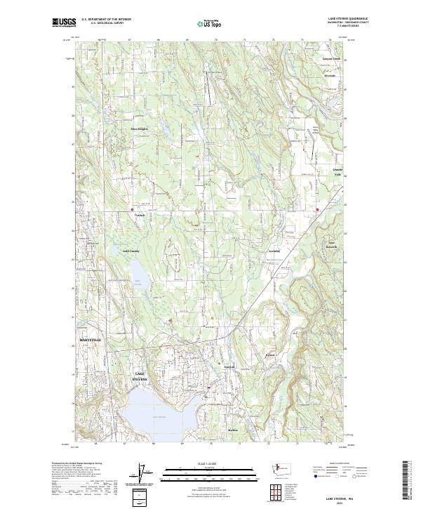
Lake Stevens and the surrounding residential corridors of Snohomish County are documented in this contemporary survey, illustrating a landscape defined by its glacial lakes and suburban expansion. The namesake Lake Stevens sits at the southern edge, while the city of Marysville extends into the western boundary. Significant water features like Lake Cassidy and Martha Lake are surrounded by established communities such as Sisco Heights, Getchell, and Lochsloy. This map captures the modern road network, including Lake Cassidy Hartford Rd and Sisco Heights Rd, which link historical rural pockets with newer developments. Industry and infrastructure are represented by the Frontier Airpark and Green Valley Airfield, alongside the winding paths of the Pilchuck River and Little Pilchuck Creek. The topography shifts from the flatlands near Marysville to the rising elevation of Getchell Hill, providing a look at the region's current drainage patterns and land use.
Find a feature on this map
108 named features on this map. Tap any name to fly to it.
Don’t see what you’re looking for? This feature index may not catch every label — zoom into the map to look around manually.
Map Details
Editions of this 2023 Lake Stevens Map
This is the sole edition of this map. No revisions or reprints were ever made.