2022 Map of Lake Wissota
USGS Topo · Published 2022About this map
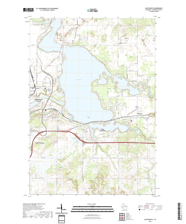
Lake Wissota dominates the landscape at the confluence of the Chippewa River and the Yellow River, where its expansive waters meet complex shorelines and residential developments. To the west, the industrial and urban edge of Chippewa Falls transitions into the growing community of Lake Hallie. This 2022 survey captures the modern road network, including the Old Abe State Trl and Seymour Cray Sr Blvd, which reflect the area's shift from industrial roots toward recreation and suburban expansion. Genealogists and local researchers will find several significant burial grounds documented, such as the Chippewa County Poor Farm Cem and Home Park Cem. Small rural clusters like Bateman and Anson remain distinct points of interest along the southern and eastern edges of the lake, while the Wissota Airport and local landmarks like T-Bo Field indicate the mix of aviation and recreational land use in Chippewa County.
Find a feature on this map
113 named features on this map. Tap any name to fly to it.
Don’t see what you’re looking for? This feature index may not catch every label — zoom into the map to look around manually.
Map Details
Editions of this 2022 Lake Wissota Map
This is the sole edition of this map. No revisions or reprints were ever made.