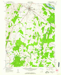
1952 Map of Leesburg
USGS Topo · Published 1960About this map
Leesburg serves as the focal point for this early 1950s survey of Loudoun County, where the rail lines of the Washington and Old Dominion intersect with the Leesburg Turnpike. The landscape is a mix of small crossroads communities and rural institutions, including Douglas Sch and the historic Oatlands estate. The presence of Evergreen Mills and multiple quarries near Trap Rock reflects the local resource-based economy, while the Potomac River forms the northeastern boundary, accompanied by the C & O Canal along the Maryland side. Waterways like Goose Creek and Sycoline Creek wind through the countryside, crossed by local landmarks such as Murrays Ford Bridge. This mapping captures the area before the significant suburban expansion of the later 20th century, preserving the locations of rural churches like Sycoline Ch and Mt Olive Ch.
Find a feature on this map
53 named features on this map. Tap any name to fly to it.
Don’t see what you’re looking for? This feature index may not catch every label — zoom into the map to look around manually.
Map Details
Editions of this 1952 Leesburg Map
This is the sole edition of this map. No revisions or reprints were ever made.
Other maps of this area

1884 · Harpers Ferry
USGS Topo · 1:125,000

1890 · Mt. Vernon
USGS Topo · 1:125,000

1891 · Harpers Ferry
USGS Topo · 1:125,000

1891 · Mt. Vernon
USGS Topo · 1:125,000

1893 · Frederick
USGS Topo · 1:125,000

1893 · Harpers Ferry
USGS Topo · 1:125,000

1894 · Warrenton
USGS Topo · 1:125,000

1894 · Frederick
USGS Topo · 1:125,000

1894 · Mt. Vernon
USGS Topo · 1:125,000

1897 · Mt. Vernon
USGS Topo · 1:125,000