2021 Map of Lennox
USGS Topo · Published 2021About this map
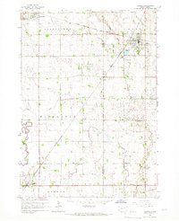
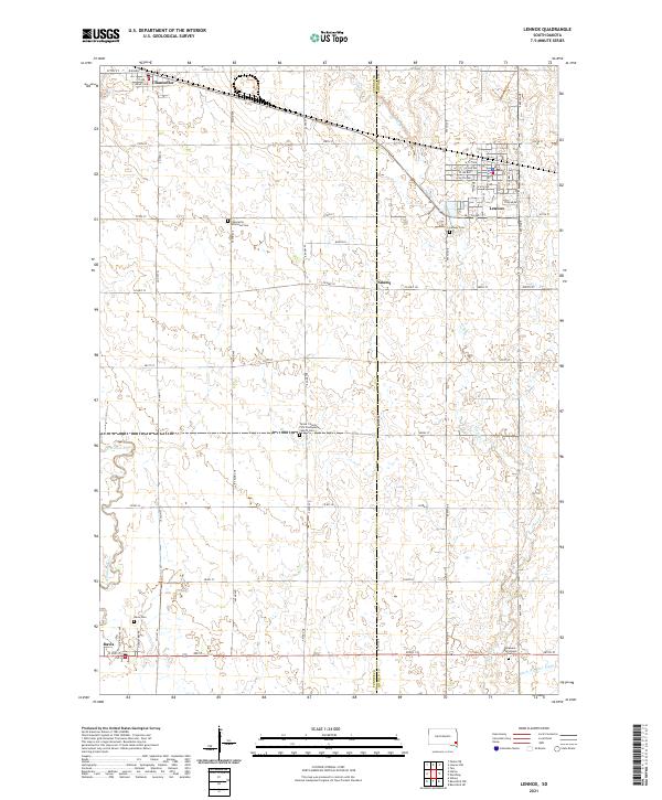
Lennox and Chancellor anchor this prairie landscape along the border of Turner and Lincoln Counties. The terrain is defined by the winding course of the Vermillion River to the west and Long Cr to the east, illustrating a highly organized agricultural grid where roads like Co Hwy 41 and 464th Ave separate vast sections of farmland. For genealogists, the map is remarkably dense with burial sites and rural congregations, including the Chancellor Reformed Cem and the Turner County First Presbyterian Church Cem. Small settlements such as Naomi and Davis provide a look at the enduring community structure of southeastern South Dakota. The presence of Ditch Number Eight in the southern reaches highlights the region's managed water systems used to support its long-standing farming tradition.
Find a feature on this map
58 named features on this map. Tap any name to fly to it.
Don’t see what you’re looking for? This feature index may not catch every label — zoom into the map to look around manually.
Map Details
Editions of this 2021 Lennox Map
This is the sole edition of this map. No revisions or reprints were ever made.