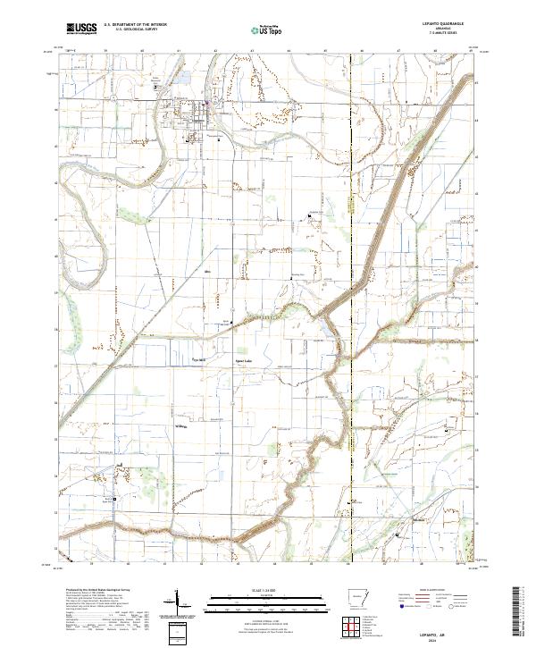
2024 Map of Lepanto
USGS Topo · Published 2024About this map
Lepanto serves as the primary hub of this eastern Arkansas landscape, where the Left Hand Chute of Little River and the Tyronza River define the local topography. This survey captures a dense network of rural communities and local cemeteries that speak to the area's deep family roots, including Whitton, Alto, and Wilbeth. The map reveals a highly structured drainage system, notably Ditch Number 516, which turned the surrounding Delta lowlands into productive acreage. For researchers of local heritage, the abundance of family and community burial grounds, such as Potter Memorial Cem, Conaster Cem, and Rock of Ages Cem, provides essential points of reference. The transition from established town streets in Lepanto, like Kenwood Ave and W Broad St, to the outlying reaches of Spear Lake and Frys Mill illustrates the traditional agricultural and hydrological patterns of Poinsett and Mississippi counties.
Find a feature on this map
87 named features on this map. Tap any name to fly to it.
Don’t see what you’re looking for? This feature index may not catch every label — zoom into the map to look around manually.
Map Details
Editions of this 2024 Lepanto Map
This is the sole edition of this map. No revisions or reprints were ever made.
Other maps of this area

1931 · Jericho
USGS Topo · 1:62,500

1939 · Jericho
USGS Topo · 1:62,500

1939 · Evadale
USGS Topo · 1:62,500

1940 · Deckerville
USGS Topo · 1:62,500

1941 · Marked Tree
USGS Topo · 1:62,500

1952 · Jericho
USGS Topo · 1:62,500

1953 · Memphis
USGS Topo · 1:250,000

1956 · Evadale
USGS Topo · 1:62,500

1956 · Marked Tree
USGS Topo · 1:62,500

1956 · Memphis
USGS Topo · 1:250,000