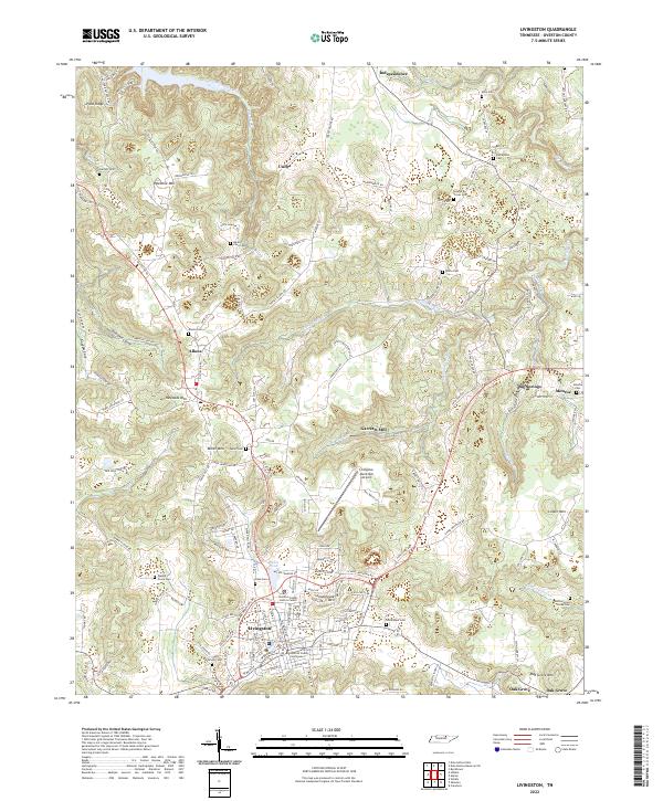
2022 Map of Livingston
USGS Topo · Published 2022About this map
The town of Livingston serves as the focal point of this Overton County survey, where the Overton County Courthouse and the Overton County Justice Center anchor the civic landscape. The surrounding terrain is defined by a series of prominent rises including Palestine Mtn, Reynolds Mtn, and Schoolhouse Mtn, which frame deep valleys and coves like Hall Cove and Hunter Cove. This modern documentation of the region reflects a landscape of small communities such as Allons, Monroe, and Independence that have persisted through generations, connected by a network of rural roads following the winding course of Mitchell Creek and Big Eagle Creek.
Find a feature on this map
158 named features on this map. Tap any name to fly to it.
Don’t see what you’re looking for? This feature index may not catch every label — zoom into the map to look around manually.
Map Details
Editions of this 2022 Livingston Map
This is the sole edition of this map. No revisions or reprints were ever made.
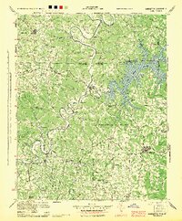
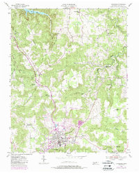
Historical Maps of Oak Grove Through Time
3 maps found