2024 Map of Logan
USGS Topo · Published 2024About this map
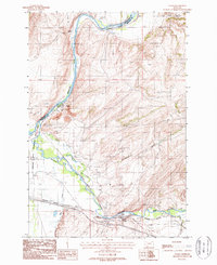
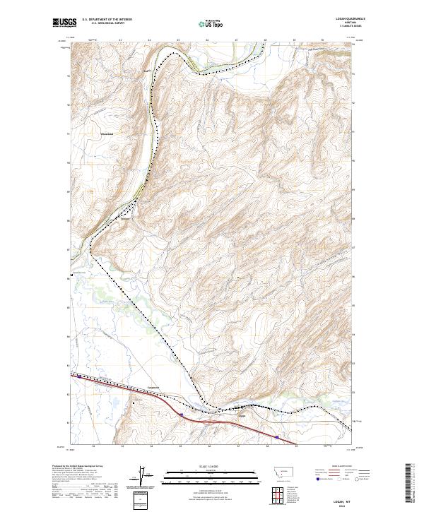
The confluence of Montana’s major waterways defines this landscape, where the Gallatin River and Missouri River shape the valley floor. Small riverside settlements including Logan, Trident, and Eustis are positioned along the river corridors, connected by a network of historic routes like Logan Trident Rd. The topography is marked by deep incisions such as Big Davis Gulch and Cottonwood Gulch, which cut through the high ground rising from the riverbanks. For local historians and genealogists, the map identifies key burial sites including the Headwaters Cem and Logan Cem.
Find a feature on this map
40 named features on this map. Tap any name to fly to it.
Don’t see what you’re looking for? This feature index may not catch every label — zoom into the map to look around manually.
Map Details
Editions of this 2024 Logan Map
This is the sole edition of this map. No revisions or reprints were ever made.