2023 Map of Loganton
USGS Topo · Published 2023About this map
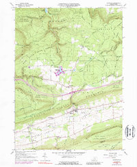
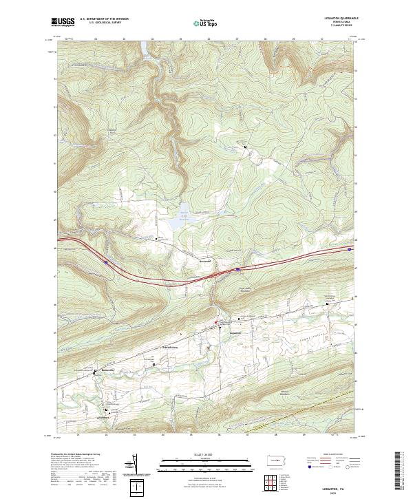
Sugar Valley forms the heart of this landscape, where the borough of Loganton serves as a central hub for the surrounding rural communities. This fertile corridor is defined by the course of Fishing Creek, which flows through a string of historic settlements including Schracktown, Booneville, and Greenburr. The area's deep-rooted history is evidenced by its numerous churchyards and burial grounds, such as the Old Schracktown Cem and the Saint Pauls Evangelical Lutheran Cem. To the north, the terrain rises sharply into the ridgelines near Chestnut Flat, where the Warren H Ohl Reservoir and Keller Reservoir manage the headwaters of McElhattan Creek. These upland areas are also marked by the extensive Bald Eagle State Forest Snowmobile Trails Trl, showing how the land uses have shifted from strictly agricultural and hydraulic management toward recreational purposes while maintaining its traditional crossroads like Rosecrans.
Find a feature on this map
122 named features on this map. Tap any name to fly to it.
Don’t see what you’re looking for? This feature index may not catch every label — zoom into the map to look around manually.
Map Details
Editions of this 2023 Loganton Map
This is the sole edition of this map. No revisions or reprints were ever made.