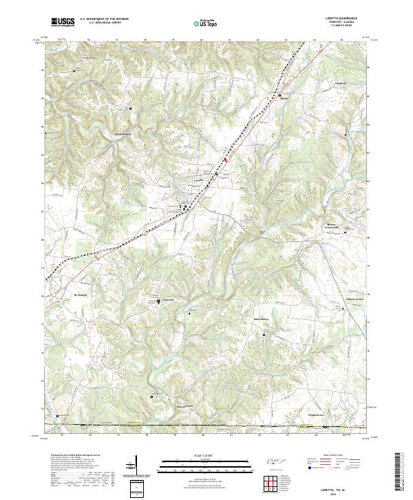
2022 Map of Loretto
USGS Topo · Published 2022About this map
Loretto and St. Joseph serve as the primary hubs in this corner of southern Middle Tennessee, where the landscape is defined by the numerous tributaries of Bluewater Cr. The settlement pattern follows the high ground of ridges like Hensley Ridge, while the valleys are deeply incised by waters such as Clack Br and Stillhouse Br. A dense network of local cemeteries, including the Sacred Heart Cem and Loretto Memorial Gardens, suggests a long-established community with deep roots in these highlands.
Find a feature on this map
110 named features on this map. Tap any name to fly to it.
Don’t see what you’re looking for? This feature index may not catch every label — zoom into the map to look around manually.
Map Details
Editions of this 2022 Loretto Map
This is the sole edition of this map. No revisions or reprints were ever made.
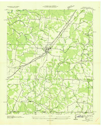
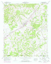
Historical Maps of Rascal Town Through Time
3 maps found