2022 Map of Mapleton
USGS Topo · Published 2022About this map
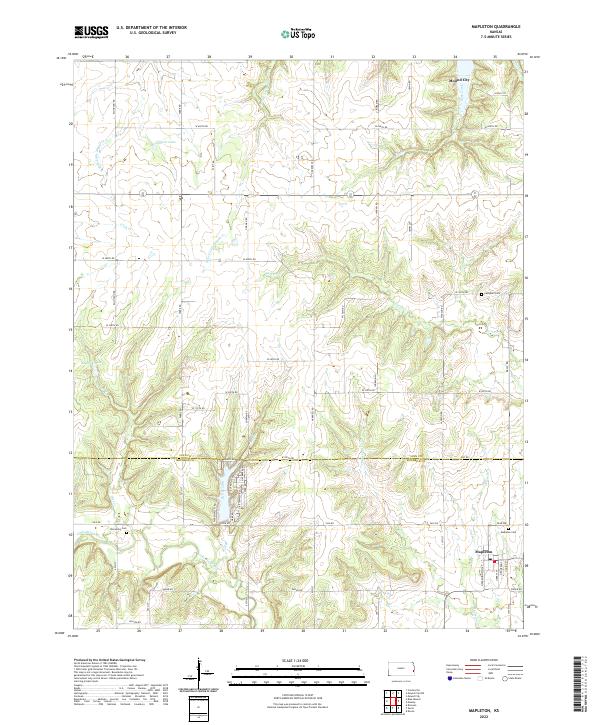
The Little Osage River meanders across the southern landscape of this Kansas quadrangle, defining the terrain near the settlement of Mapleton. This modern topographic study reveals a deeply dissected prairie landscape where the Linn Co and Bourbon Co line intersects a network of rural routes like Yale RD and W 200th RD. To the north, the drainage systems of the N Fork Little Sugar Cr and S Fork Little Sugar Cr converge near Johnson Lake, illustrating the watershed's complex flow toward the Mound City area. Local history is anchored by several established burial sites, including Mapleton Cem and Stevenson Cem, which serve as vital markers for genealogical research. The map also captures smaller water features like Bell Br and Opossum Cr, showing how these tributaries have historically shaped land use and property boundaries in this agricultural region.
Find a feature on this map
64 named features on this map. Tap any name to fly to it.
Don’t see what you’re looking for? This feature index may not catch every label — zoom into the map to look around manually.
Map Details
Editions of this 2022 Mapleton Map
This is the sole edition of this map. No revisions or reprints were ever made.