2022 Map of Marshall
USGS Topo · Published 2022About this map
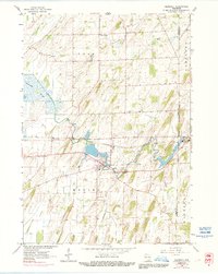
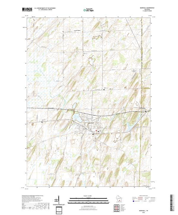
The Maunesha River winds through this region of eastern Dane County, anchoring the village of Marshall, where it widens into the Marshall Millpond 72. This landscape is defined by its transition between agricultural uplands and significant wetland systems like the Deansville Marsh. The settlement pattern reveals several small communities and historic nodes, including Deansville and York Center, alongside the western edge of Waterloo. Genealogists will find a high density of burial sites across the township, such as York Center Cem, Deansville Cem, and Medina Cem. Transport and aviation are represented by the rural Der Schwarzwald Airport, located near the intersection of the county borders. The map detail highlights the intricate drainage network formed by Mud Cr and Spring Cr as they feed into the primary river valley.
Find a feature on this map
77 named features on this map. Tap any name to fly to it.
Don’t see what you’re looking for? This feature index may not catch every label — zoom into the map to look around manually.
Map Details
Editions of this 2022 Marshall Map
This is the sole edition of this map. No revisions or reprints were ever made.