2024 Map of Martinez
USGS Topo · Published 2024About this map
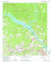
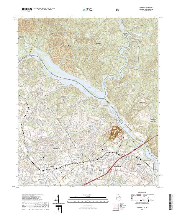
Martinez and Evans serve as the suburban anchors of this 2024 landscape, where the rapidly developing corridor of Columbia Heights meets the wooded edges of the Sumter National Forest. The Savannah River defines the geography, winding past Ninety Nine Islands and the wide stretch of Four Mile Reach. Historical connections to the river remain visible through named crossings like Shaw and McKie Ferry and Furys Ferry, while the interior is marked by numerous family and church burial grounds including Taylor Cem, Crafton Cem, and the Hopewell Baptist Church Graveyard. Educational institutions such as Georgia Military College - Augusta and Brenau University - Augusta are situated south of Martinez Blvd, indicating the modern academic character of the Augusta periphery. The map also captures the varied terrain from the heights of Poverty Hill to the wetlands surrounding Mullens Lake and Bowen Pond.
Find a feature on this map
57 named features on this map. Tap any name to fly to it.
Don’t see what you’re looking for? This feature index may not catch every label — zoom into the map to look around manually.
Map Details
Editions of this 2024 Martinez Map
This is the sole edition of this map. No revisions or reprints were ever made.