2023 Map of Matoaka
USGS Topo · Published 2023About this map
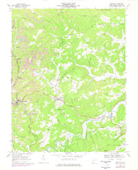
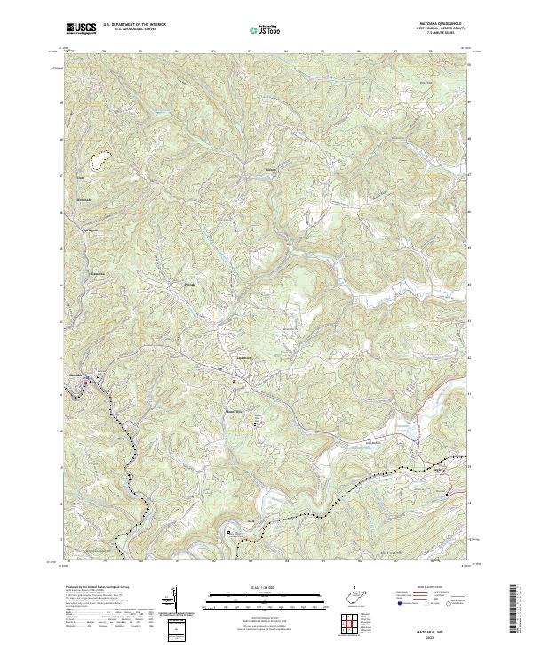
The Bluestone River winds through the heart of this Mercer County landscape, where narrow valleys dictate the placement of small communities and complex road networks. The settlement of Matoaka serves as a key point of reference, surrounded by several smaller locales including Lashmeet, Beeson, and Hiawatha. These villages are often linked by the remnants of older transportation corridors, such as the Old Railroad Grade Rd, reflecting the area's history of movement through the Appalachian terrain. Genealogists and local historians will find several well-defined burial grounds across the ridges, notably the Matoaka Cem, Mount Olive Cem, and Saint Peters Lutheran Cem. The topography is defined by prominent elevations such as Nubbin Ridge and Black Oak Mtn, which separate the many drainage forks and branches that feed into the larger river system.
Find a feature on this map
131 named features on this map. Tap any name to fly to it.
Don’t see what you’re looking for? This feature index may not catch every label — zoom into the map to look around manually.
Map Details
Editions of this 2023 Matoaka Map
This is the sole edition of this map. No revisions or reprints were ever made.