Loading...
Loading map...2024 Map of Matthews
USGS Topo · Published 2024About this map
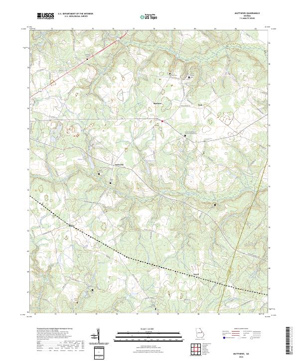
The settlement of Matthews sits at the northern end of this rural landscape, which is defined by an intricate network of creeks and small family-run cemeteries. Moving south through Noah and Stellaville, the terrain is drained by numerous watercourses including Brushy Creek and Flat Rock Branch. The area's social fabric is evident in the cluster of landmarks near Stellaville, where Ways Grove Church and its associated Ways Grove Cem are found alongside Ways Cem.
Find a feature on this map
81 named features on this map. Tap any name to fly to it.
Don’t see what you’re looking for? This feature index may not catch every label — zoom into the map to look around manually.
Map Details
Date Portrayed2024
Date Published2024
PublisherU.S. Geological Survey
Map TypeTopographic
Scale1:24000
Physical Dimensions24 x 29 inches
Editions of this 2024 Matthews Map
This is the sole edition of this map. No revisions or reprints were ever made.
Historical Maps of Zebina Through Time
Featured Locations
Source Details
SourceU.S. Geological Survey
CopyrightPublic Domain