2022 Map of Mayer
USGS Topo · Published 2022About this map
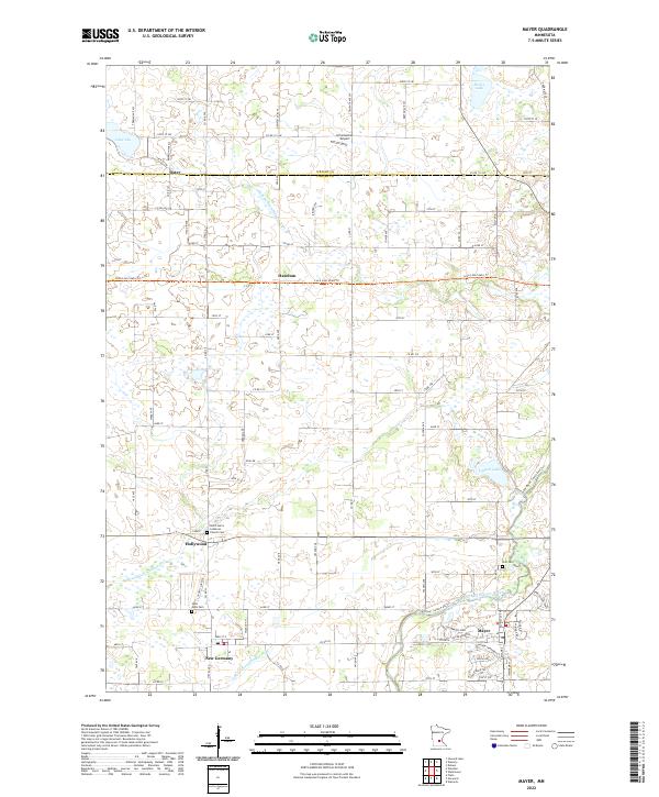
Mayer and New Germany anchor the southern portion of this landscape where the South Fork Crow River meanders toward the east. The terrain is defined by an extensive network of drainage systems, including Judicial Ditch Number One, Judicial Ditch Number Four, and County Ditch Number Nine, which speak to the area's agricultural heritage and water management history. Small rural clusters like Hollywood, Hazelton, and Oster are scattered along a grid of township roads, many of which follow the Wright and Carver county line. The Luce Line State Trail cuts a straight path across the center, following a former rail corridor that once linked these farming communities. Local history is preserved at sites like Saint John's Lutheran Church and several community burial grounds, including Saint Mark Cemetery and Zion Cemetery, reflecting the enduring footprint of early Lutheran settlement in this part of Minnesota.
Find a feature on this map
93 named features on this map. Tap any name to fly to it.
Don’t see what you’re looking for? This feature index may not catch every label — zoom into the map to look around manually.
Map Details
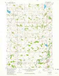
Editions of this 2022 Mayer Map
This is the sole edition of this map. No revisions or reprints were ever made.
Historical Maps of Camden Township Through Time
Featured Locations
- Woodland Township, MN
- Mayer, MN
- New Germany, MN
- Hazelton, Hollywood Township
- Hollywood, Hollywood Township