Loading...
Loading map...2022 Map of McCausland
USGS Topo · Published 2022About this map
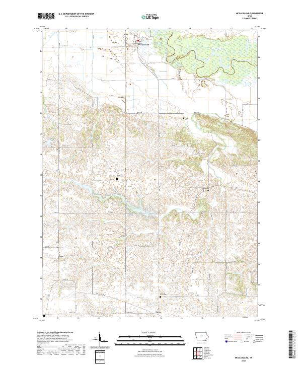
The Wapsipinicon River meanders across the northern portion of this landscape, forming the natural boundary between Clinton and Scott counties. The town of McCausland serves as the local hub, situated just north of where the river's wetland-rich valley meets the agricultural uplands. This area is characterized by several small watercourses, including Jones Cr and Martin Cr, which drain into the river, and the larger Lost Creek system further south.
Find a feature on this map
40 named features on this map. Tap any name to fly to it.
Don’t see what you’re looking for? This feature index may not catch every label — zoom into the map to look around manually.
Map Details
Date Portrayed2022
Date Published2022
PublisherU.S. Geological Survey
Map TypeTopographic
Scale1:24000
Physical Dimensions24 x 29 inches
Editions of this 2022 McCausland Map
This is the sole edition of this map. No revisions or reprints were ever made.
Historical Maps of McCausland Through Time
1 maps found
Featured Locations
Source Details
SourceU.S. Geological Survey
CopyrightPublic Domain