2023 Map of McClure
USGS Topo · Published 2023About this map
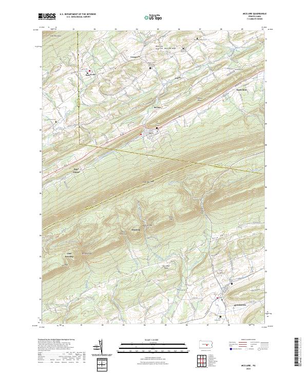
Shade Mountain forms a massive central ridge that divides this landscape, creating a distinct physical barrier between the northern settlements of McClure and Bannerville and the southern valley near McAlisterville. This geography dictates the local transport and settlement patterns, with roads like Stage Rd and Singing Bridge Rd following the narrow valleys and gaps. The map is particularly rich for genealogical research, documenting several denominational and community burying grounds such as Bakers United Methodist Church Cem and Samuels Church Cem, alongside smaller family-named hamlets like Raubs Mills and Crossgrove. The varied terrain includes several named water gaps, including Tennis Gap and McAlister Gap, which have historically served as the primary conduits for travel through the ridge-and-valley system. The presence of Snook Airport north of South Branch Middle Creek adds a modern aviation layer to this rural Pennsylvania environment.
Find a feature on this map
88 named features on this map. Tap any name to fly to it.
Don’t see what you’re looking for? This feature index may not catch every label — zoom into the map to look around manually.
Map Details
Editions of this 2023 McClure Map
This is the sole edition of this map. No revisions or reprints were ever made.
Historical Maps of Little Roundtop Through Time
1 maps found