2022 Map of McCoy
USGS Topo · Published 2022About this map
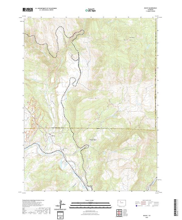
McCoy and Bond serve as the primary hubs in this high-country landscape where the Colorado River winds through the southwestern corner. The mapping reveals a complex network of water management and irrigation essential to the region, including the Kayser Mutual Ditch, McCoy Reservoir, and Yarmony Reservoir. This terrain is defined by dramatic elevation changes, rising from the river valley to the heights of Black Mtn and the Gore Range in the northeast, and Yarmony Mtn in the southeast. For those tracing local heritage, the McCoy Cemetery sits north of the river, while numerous forest service and county roads like Conger Mesa Rd and Table Rock Rd provide access to the surrounding uplands and landmarks such as Copper Spur.
Find a feature on this map
58 named features on this map. Tap any name to fly to it.
Don’t see what you’re looking for? This feature index may not catch every label — zoom into the map to look around manually.
Map Details
Editions of this 2022 McCoy Map
This is the sole edition of this map. No revisions or reprints were ever made.
Historical Maps of McCoy Through Time
1 maps found