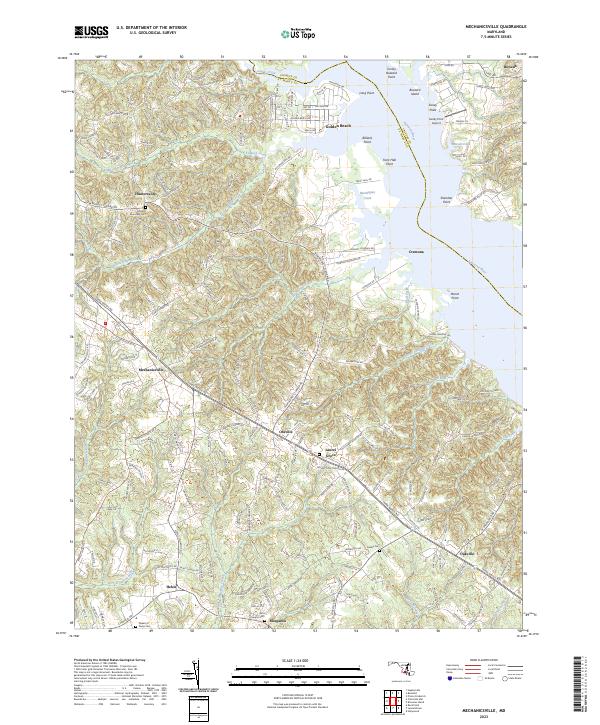
2023 Map of Mechanicsville
USGS Topo · Published 2023About this map
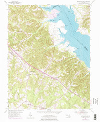
Mechanicsville and the surrounding Maryland tidewater country are defined by the intricate drainages feeding the Patuxent River and Saint Clements Creek. This landscape is marked by colonial-era roots, evidenced by historical religious sites like the All Faith Episcopal Cem near Huntersville and Saint Joseph's Cem in Morganza. The road network follows established paths, most notably Three Notch Rd and Point Lookout Rd, which serve as the primary conduits between rural hamlets such as Oraville, Laurel Grove, and Helen. Along the riverbanks, distinct landforms like Trent Hall Point and Sheridan Point delineate the shoreline, while numerous creeks like Killpeck Creek and Locks Swamp Creek carve through the coastal plain. The map documents a blend of residential growth at Golden Beach alongside the preserved path of the Potomac Heritage National Scenic Tr.
Find a feature on this map
50 named features on this map. Tap any name to fly to it.
Don’t see what you’re looking for? This feature index may not catch every label — zoom into the map to look around manually.
Map Details
Editions of this 2023 Mechanicsville Map
This is the sole edition of this map. No revisions or reprints were ever made.