2023 Map of Midland
USGS Topo · Published 2023About this map
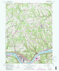
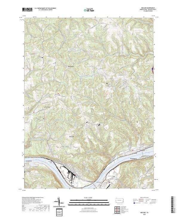
The Ohio River carves a dominant path through this portion of Beaver County, defining the industrial and residential character of riverfront towns like Midland and Shippingport. The landscape is a transition from the heavy manufacturing corridors served by the J and L Mill Operation Pvt RR to the dissected uplands of Ohioville and Blackhawk. These higher elevations are marked by a dense network of small watercourses such as Sixmile Run and Wolf Run, which have carved the terrain into a series of ridges and hollows that historically dictated settlement patterns.
Find a feature on this map
143 named features on this map. Tap any name to fly to it.
Don’t see what you’re looking for? This feature index may not catch every label — zoom into the map to look around manually.
Map Details
Editions of this 2023 Midland Map
This is the sole edition of this map. No revisions or reprints were ever made.