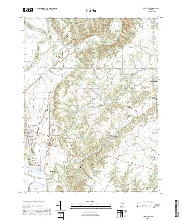
2022 Map of Montezuma
USGS Topo · Published 2022About this map
The Wabash River and Sugar Creek define the western and northern edges of this Indiana landscape, where the border between Vermillion Co and Parke Co follows the river's winding course. This area is characterized by a dense network of rural settlements and family burial grounds, such as Bloomingdale Friends Cem and the Oakland Cem near Montezuma. Small communities like West Union, Annapolis, and Bloomingdale are linked by a grid of county roads, including the historical Tow Path RD that parallels the river. The southern portion is marked by the confluence of several waterways, including Big Raccoon Creek and Leatherwood Creek, creating the distinct terrain of Hethcoe Bottoms. Notable local sites such as Armiesburg and Coloma reflect the long-standing agrarian and community structure of the region, which has maintained its rural character even as transportation evolved from river-adjacent paths to modern routes like Midway RD.
Find a feature on this map
90 named features on this map. Tap any name to fly to it.
Don’t see what you’re looking for? This feature index may not catch every label — zoom into the map to look around manually.
Map Details
Editions of this 2022 Montezuma Map
This is the sole edition of this map. No revisions or reprints were ever made.
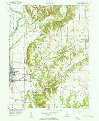
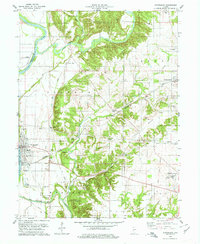
Historical Maps of Coloma Through Time
3 maps found