Loading...
Loading map...2022 Map of Montpelier
USGS Topo · Published 2022About this map
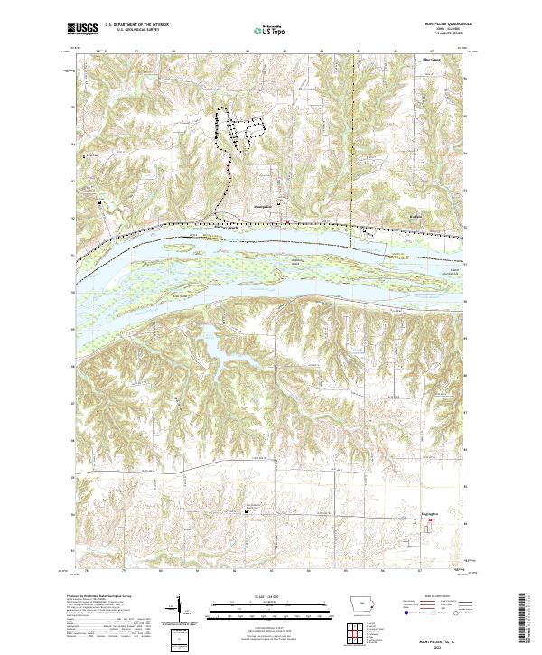
The Mississippi River creates a wide, braided corridor across this landscape, defining the state boundary between Muscatine County, Iowa and Rock Island County, Illinois. The river is dominated by large landforms such as Andalusia Island and Arab Island, separated from the main banks by Andalusia Slough and Arab Chute. On the Iowa side, the bluffs rise sharply from the water, where the small settlement of Montpelier and the riverside community of Midway Beach are situated.
Find a feature on this map
92 named features on this map. Tap any name to fly to it.
Don’t see what you’re looking for? This feature index may not catch every label — zoom into the map to look around manually.
Map Details
Date Portrayed2022
Date Published2022
PublisherU.S. Geological Survey
Map TypeTopographic
Scale1:24000
Physical Dimensions24 x 29 inches
Editions of this 2022 Montpelier Map
This is the sole edition of this map. No revisions or reprints were ever made.
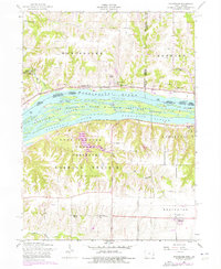
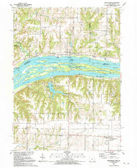
Historical Maps of Midway Beach Through Time
3 maps found
Featured Locations
Source Details
SourceU.S. Geological Survey
CopyrightPublic Domain