2023 Map of Mount Vision
USGS Topo · Published 2023About this map
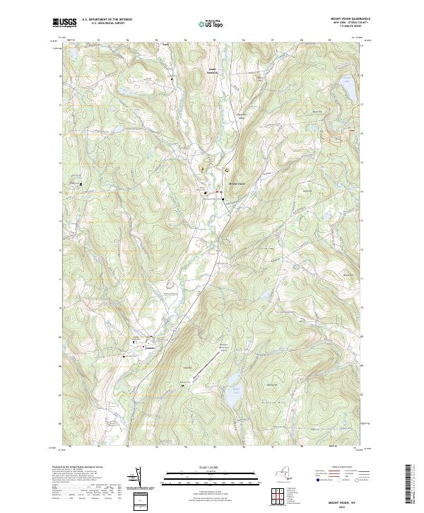
Otego Creek and its tributary, the West Branch Otego Creek, carve a central valley through this Otsego County landscape, anchoring the hamlets of Mount Vision and South Hartwick. The terrain is defined by a series of prominent ridges, including Bowe Hill and Gifford Hill, where the drainage patterns of Oneonta Creek and Wharton Creek shape the agricultural and woodland boundaries. The southern portion of the quadrangle is marked by the presence of the Oneonta Municipal Airport and the village of Laurens, situated near the confluence of Lake Brook and Pool Brook. For genealogists and local historians, the map preserves the locations of numerous burial grounds, such as Laurens Village Cem and the Old Mount Vision Cem. These sites, along with family-named landmarks like Babcock Cem, offer a modern record of the area's deep-rooted rural settlement patterns and historic cemeteries.
Find a feature on this map
111 named features on this map. Tap any name to fly to it.
Don’t see what you’re looking for? This feature index may not catch every label — zoom into the map to look around manually.
Map Details
Editions of this 2023 Mount Vision Map
This is the sole edition of this map. No revisions or reprints were ever made.
Historical Maps of Milford Through Time
1 maps found