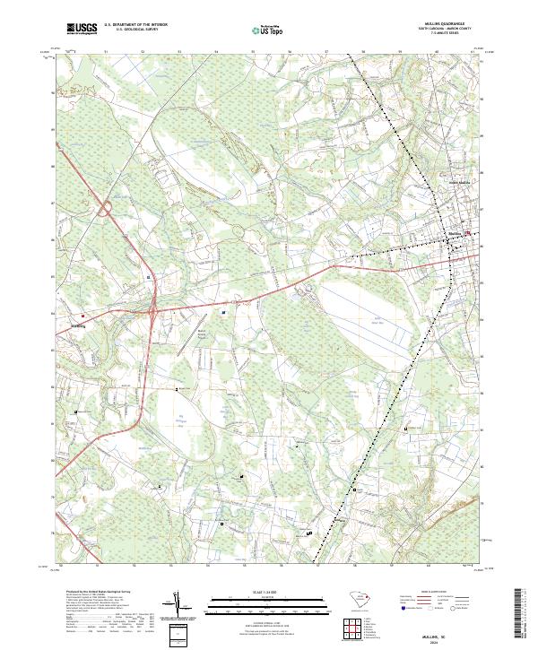
2024 Map of Mullins
USGS Topo · Published 2024About this map
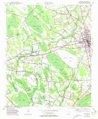
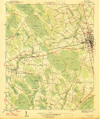
Mullins and North Mullins anchor the eastern side of this South Carolina landscape, where the flat coastal plain is defined by a dense network of Carolina Bays and intricate swamp systems. These elliptical depressions, such as Big Sister Bay, Grassy Bay, and Piney Bay, create a unique mosaic across the terrain, influencing road placement and agricultural patterns. The drainage network is equally complex, dominated by the winding path of Maidendown Swamp and Smith Swamp, which feed into Reedy Creek and Little Reedy Creek.
Find a feature on this map
182 named features on this map. Tap any name to fly to it.
Don’t see what you’re looking for? This feature index may not catch every label — zoom into the map to look around manually.
Map Details
Editions of this 2024 Mullins Map
This is the sole edition of this map. No revisions or reprints were ever made.