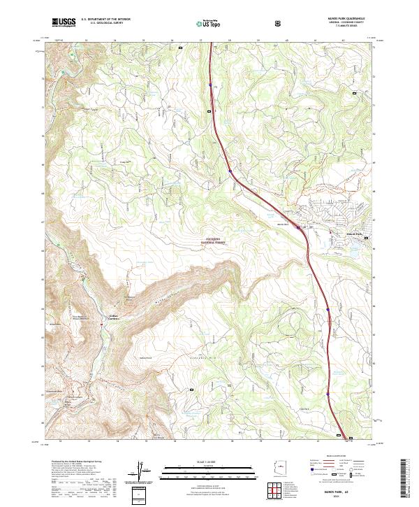
2021 Map of Munds Park
USGS Topo · Published 2021About this map
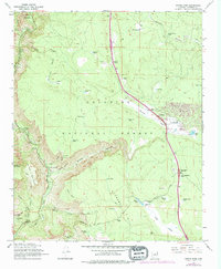
Coconino National Forest encompasses the dramatic elevation changes of this high-country landscape, where the settlement of Munds Park serves as a primary residential hub along Interstate 17. The terrain is defined by a complex network of canyons and high points, including the prominent Wilson Mtn and the sheer walls of Oak Creek Canyon. This 2021 survey illustrates a modern recreation-focused infrastructure, with numerous managed trails such as the Thomas Point Trl, Cookstove Trl, and the Wilson Mountain Trl providing access to landmarks like Midgley Bridge and Steamboat Rock.
Find a feature on this map
95 named features on this map. Tap any name to fly to it.
Don’t see what you’re looking for? This feature index may not catch every label — zoom into the map to look around manually.
Map Details
Editions of this 2021 Munds Park Map
This is the sole edition of this map. No revisions or reprints were ever made.