2022 Map of Nunn
USGS Topo · Published 2022About this map
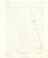
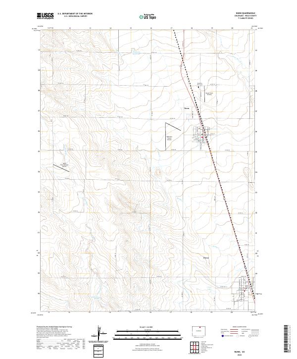
Agricultural and aviation activity characterize this part of Weld County, where the towns of Nunn and Pierce anchor the high plains landscape. Small private airfields like the Shaull Farm Airstrip, Bellmore Farms Airport, and Reed International Airport are scattered across the township lines of T9N R67W and T8N R66W, suggesting the vital role of general aviation in this rural expanse. The terrain is marked by seasonal drainage systems and local water management features, including Lone Tree Cr, Spring Cr, and the Pierce Lateral irrigation ditch.
Find a feature on this map
53 named features on this map. Tap any name to fly to it.
Don’t see what you’re looking for? This feature index may not catch every label — zoom into the map to look around manually.
Map Details
Editions of this 2022 Nunn Map
This is the sole edition of this map. No revisions or reprints were ever made.
Historical Maps of Pierce Through Time
2 maps found